
SEDALIA — Severe Weather Preparedness Week is March 6 through 10, and the Sedalia-Pettis County Emergency Management Agency is providing information about what to plan for if bad weather occurs this spring.
Each day of the week will address a specific aspect of severe weather in the Sedalia/Pettis County area. Monday stresses preparedness. Erin Matheny, Sedalia-Pettis County EMA deputy director, noted in a news release that the best way to prepare for severe weather is to have a plan and build an emergency kit for the house, vehicle, and office. The National Weather Service (NWS) and Ready.gov are great resources for developing an emergency plan and home and workplace kits. It is also essential to have three forms of communication on hand in case one or two forms become unavailable during and after the severe weather.
An NOAA All Weather Radio receives weather updates from the National Weather Service and has battery power capabilities should the power go out. The Emergency Management Office programs the weather radios for free; call the office at 660-827-4800 to schedule the programming.
Be sure to listen to the television announcements, radio broadcasts, and cell phone alerts that pop up during severe weather. It is federally mandated that all NWS alerts be sent out via these outlets to warn the community using the Wireless and Emergency Alert Systems.
Tuesday will focus on tornados, and the state-wide tornado drill is scheduled for 10 a.m. Tuesday, March 7. It is highly encouraged for businesses, schools, and those at home to participate in the drill.
One must be aware that tornadoes can happen anytime and anywhere. Knowing the difference between a watch and a warning is also essential. A “Watch” means to be prepared; severe weather is in the area and may develop into something more. A “Warning” is a signal to take immediate action. For example, a tornado has been spotted in the area or on the radar.
“When a Tornado Warning is issued, seek shelter immediately inside the innermost room on the lowest level of the building or in a safe room,” Matheny noted in the release. “Avoid wide open rooms, such as gyms or auditoriums.
“Stay away from windows, doors, and exterior walls,” she continued. “Get low to the ground and protect your head and neck. Do not stop under an overpass or bridge if driving in a vehicle. Instead, find a low and flat location to lay down in and protect your head and neck as best as possible.”
Lightning is the focus on Wednesday. Information provided by Matheny stated lightning is one of the leading causes of weather-related injuries and deaths. Lightning does not have to be seen to be struck by it. The saying “When Thunder Roars, Go Indoors” is true; stay away from windows and exterior doors. Lighting often strikes 3 miles from the center of the thunderstorms and can hit 10-15 miles from thunderstorms. Lightning can travel through power cables, plumbing, and other electrical cords.
Avoid using items during thunderstorms and lightning such as running water, electronic devices or cords connected to an outlet, and corded phones (cordless and cell phones are safe to use). Also, remember never to leave pets chained up or in dog houses outside during a thunderstorm.
Thursday focuses on wind and hail. Severe damage can happen if wind speeds are sustained at 40-50 mph. Straight-line winds are a hazard for Pettis County and neighboring areas, and they sometimes can exceed 100 mph and cause tornado-like damage to buildings and property.
Matheny noted hail usually occurs during severe thunderstorms and falls in multiple sizes, from pea size (1/4 inch) to softball size (4 1/2 inch). Therefore, one should seek shelter in a sturdy building and away from windows and exterior walls during strong winds and hail.
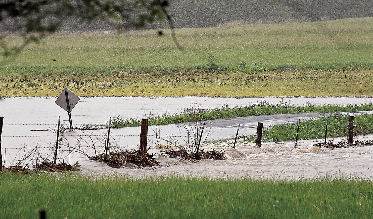
Flooding is the topic on Friday. Flash floods often occur in low-lying county areas due to heavy rains in a short period. The roads most likely to flood have signs warning drivers to look for water across the roadway during and after heavy rainfall.
Remember the quote, “Turn Around, Don’t Drown,” regarding water across roadways. All it takes is 6 inches of fast-moving water for a grown person to be knocked off their feet and only one foot of rushing water to carry away most cars. Two feet of rushing water can carry away larger vehicles such as SUVs and trucks.
Matheny suggests listening to the Flash Flood Watches and Warnings that the NWS issues and being aware of surroundings when driving during or after heavy rainfall.


